The different lines connect between them and other trains, to cover Paris and some towns located in the suburb.

Above are the Paris subway map for each line:
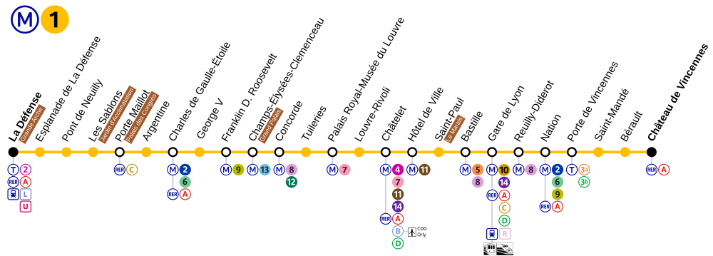
Paris subway map line 1
 Line 1: La Défense/ Château de Vincennes
25 stations
Paris subway map line 2

25 stations
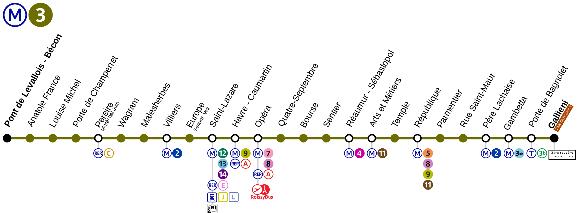
Paris subway map line 3


38 stations
Paris subway map line 7bis
Paris subway map line 7bis


Line 14: Saint-Lazare / Olympiades
9 stations
9 stations
The different lines have connections with the RER(s), with the funiculaire of montmartre, with buses and tramways.
Above is a printable copy of the whole Paris subway map for the 16 lines, you will have a better understanding of all the different connections. Paris subway map
Sources: Wikimedia commons (M00tty)
Sources: Wikimedia commons (M00tty)
No comments:
Post a Comment